We had some pretty epic plans set for this weekend. The first one was to complete the Great Range Traverse in under 24 hours, next was to make a trip up to Mount Washington for some classic ice climbs. After all was said and done, we settled on a trip to Puffer Mountain. Cam and Charles came along this time for the trip. The Adirondack Rock book has one climb recorded for the cliff at this mountain, so there was definitely potential for new routes. We were unsure if there was going to be any ice at the cliff, but the conditions that we encountered along the approach sure seemed promising. The first mile or so of the hike was on a blazed trail, so there was no bushwhacking involved.
 |
| Starting off the approach, Cam breaking trail. |
 |
| The higher we go, the deeper it gets. |
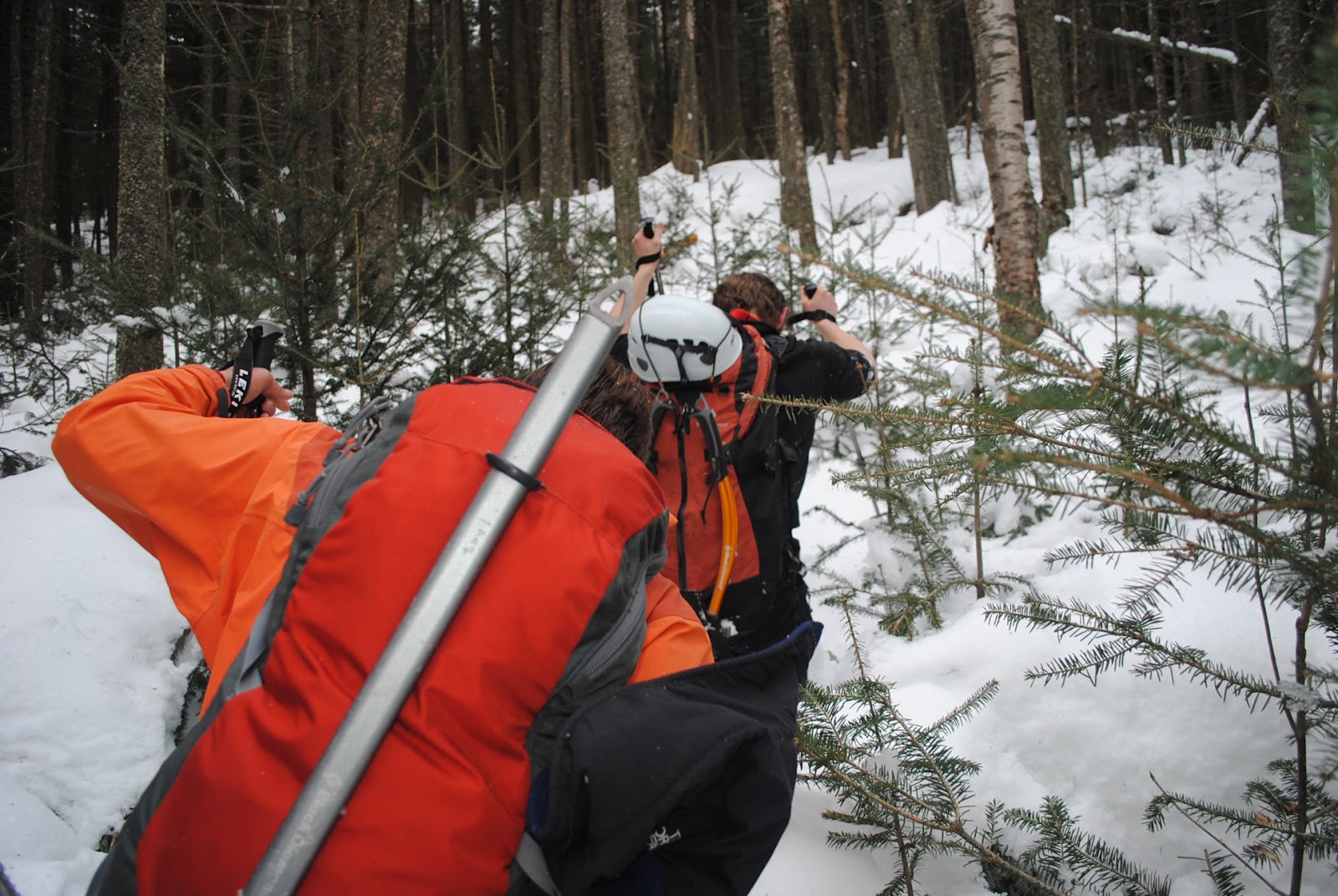
If only we were that fortunate for the next 5 hours. Not only was the snow knee to chest deep throughout most of the "trail", but there also wasn't a trail. To save time we decided to take a direct route to the summit instead of looping around. Lesson learned, do not follow ridges in the Adirondacks. We took a wrong turn somewhere along the ridge about 6 hours, and miles, in to the approach and made the call to turn away from the climb and just head back to the car. This wasn't an easy feat either. Still lots of bushwhacking and deep snow, along with sections that were plenty steep and an ice cliff that we had to jump from to get to a lower section.
 |
| Here I am breaking trail in the knee deep snow . |
 |
| Looking up at the "ice cliff" jump. The only way down was to hop and slide from above the dirty ice to the deep powder below. It was a surprisingly soft landing. |
 |
| Charles starts to break trail after the jump. The snow here goes past the chest and right to his armpits. |
 |
| Heading further down the trail it gets very steep. The camera isn't even tilted in this photo, see the vertical trees as proof. |
 |
| Cam breaks trail down this section. I followed directly after and took a pretty nasty spill. Lets just say that I got pretty lucky not getting injured. |
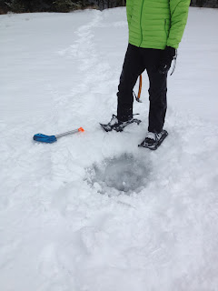
About an hour later we made it to the edge of Puffer Pond, which is where we wanted to be. All three of us were well exhausted from the long hike through deep snow, so we took an hour break to cook some food and rest before the final push to the car. There were two ways to get back to the trail we wanted to be at, which was across the pond. One way was to hike around the perimeter of the pond, and the other was to take the direct route over the ice. As I was getting the stove set up to boil some water, Cam took a walk out with his avalanche shovel and ice axe to figure out how thick the ice was. The first spot close to shore was at least 8 inches thick, and the second spot a bit further out was the same thickness. Not only was the ice plenty thick to support our weight, but there was also a foot of snow covering the entire pond. From here on out it was smooth sailing. An hour later we were back where we started.
It was a bummer to make the decision to abandon the climb, especially because all the weight that Charles and I were carrying was from protection and the rope, but we will definitely be back to find the ice.
.JPG) |
| Checking out the ice thickness at the second test hole...plenty thick. |
 |
| Cam leads the way across the pond... |
 |
| ...as I follow behind with Charles on the tail end. |
 |
| Panorama from the center of the pond. |


.JPG)


did you guys follow the approach detailed in adirondack rock? i'm curious about the potential of a ski route from siamese ponds to kings flow...
ReplyDelete-peter
We tried to follow it but ended up making a wrong turn somewhere along the way.
Deletecool. adirondack rock says to follow an old logging road, and turn left off it at the stream. i'm just curious how much further it goes.
Delete