Showing posts with label Ice. Show all posts

Tuesday, February 19, 2013

Poke-O and Chapel Pond Ice Conditions

Heading south on I-87, The Northway, we drove by Poke-O and Chapel Pond.  There were climbers all over Poke-O and a few around Chapel Pond Canyon, but none on Chapel Pond Slabs.  We didn't stop the car to get any photos, but here are a couple videos of the conditions.  Next time I'll have to hold my phone in landscape mode to make for better viewing, but this'll have to do for now.


Saturday, January 19, 2013

Mt. Hood North Face Right Gully Attempt

The NF right gully goes up the gully in the center of the face. Cooper Spur is the broad snow slope to the left and Sunshine is on the right hand edge of the photo.

It's crunch time for me now. Between all the other commitments I have had over this month and a half long break, climbing has been hard to fit in. I met with Anastasia this weekend to try the Right Gully on the North Face (actually NE Face) of Mt. Hood. We met at Timberline Lodge, an old WPA building at treeline on the south side of Mt. Hood so that we could leave the car there and do a summit carryover. A carryover is highly recommended for the route because the two other realistic descent options, Cooper Spur and Sunshine are suboptimal for sure. Cooper Spur regularly kills people with its steep, sometimes slushy snow and a fall line over cliffs, 2000 feet below. Sunshine is long and requires negotiating a large bergschrund and several other snow moats. We arrived at the trailhead soon thereafter and set out up the Tilly Jane trail towards the cabin.

The car in the parking lot right before we left.

The sun set quickly and the temperature dropped quickly. A crescent moon rose above the mountain and there was no wind, a good sign for tomorrow.

Crescent moon over Mt. Hood. Tilly Jane Trail.

We reached the cabin after two hour's walk, averaging about 1000 feet per hour. A moderate, easy pace. The cabin was, surprisingly, open, so we stopped for food and water there where we could sit easily.

Tilly Jane A-Frame

Leaving the cabin we walked up along the steep drainage to the open snow slopes above timberline. In places the snow had blown off to solid sun crust. Anastasia used snowshoes the whole way while I opted to walk without crampons or snowshoes.

The entrance to the CS Shelter and the tent of the people who came looking for us the next day.
Inside the shelter, preparing dinner and sorting gear.

Arriving at the Cooper Spur Shelter, we promptly entered and cooked dinner. Freeze dried food, tea, and cliff bars. The shelter was nicely shoveled out and plenty roomy for two people. Melting enough water took nearly two hours.

Warm and comfortable for the night.

We set the alarm for 2AM and I went to sleep. I was glad I brought the 0 down bag because it was very warm and comfortable. Anastasia, sleeping in only clothes was cold much of the night. We woke at 1:45AM, made breakfast, and headed out by 2:45. 

Progress up the glacier was methodical and slow, more a function of the pace than out of necessity. We needed crampons getting off the moraine onto the glacier, but once there we decided to use snow shoes. This was certainly a good decision. some of the walk was hard and slippery, some powder, but most of it was a breakable crust. The wind began to blow at around 7500' and steadily increased. By 8500' it was considerable (20-25 mph). We hunkered down in some holes dug with a snowshoe to wait for the sunrise, and shivered in the dark. I tried to light the stove, but with the wind and a cold lighter, I could not. In doing so, a lot of spindrift entered my gloves. There was not much room for error in this weather.

Spin drift in the flash just before sunrise. The dim rock to the upper left of Anastasia is right of the base of the route.
Plumes of snow off Cooper Spur as morning arrives.

Packing up, I encouraged Anastasia to at least look at the bergshrund because I thought the wind behind the cleaver might be less. We arrived there and changed into crampons, geared up, and roped up. Here I discovered she did not have goggles with her, but we thought it might be a possibility to climb it if the wind decreased. All the while above us, huge sprays of spin drift were bouncing off the gully walls.

The bergschrund and the base of the route. Notice to spin drift above.
Below the 'schrund.

Anastasia led out first, up to the bergshrund and immediately found a snow bridge. She disappeared around the corner with a muffled comment on how "it looks pretty sketchy...". A minute later she reappeared on the top of the 'schrund and soon the rope came tight. If this was how it would go, things were looking good.

Anastasia leading out through the bergschrund. Notice a cloud cap has started to form.
150' above the 'schrund. The first ice choke is visible above. We stopped at the hook shaped rock up right of Anastasia.

She kicked up a hundred feet or so further, but the wind was just as strong. Forty mile per hour gusts knocked us around. With a pack I weight 205-210 pounds and I was nearly being lifted off my feet at times. It must have been worse for her. She stopped and waited for me to come up, to decide what to do. We opted to go for the rock to the upper right of Anastasia in the photo above and discuss. I led and soon found myself at the rock. Showers of spin drift hammered down from above, sometimes three or four inches thick. Looking up I could see it pour off the ice chute above, plunge to the moderate slope below, and fan out, rushing down the fan.

Me below, loving the weather.

After briefly waiting to see if the winds would calm, we headed down. Since Anastasia only had glasses, every ten steps she had to clear them. Soon down on the glacier propper we walked slowly through the deep, loose snow. She spied some water ice over on the cliffs by the Cooper Spur route, so we left to investigate. If we couldn't get some real climbing on the NF, why not do some where we could. I led what was intended to be the first pitch, but even here the wind was nearly knocking me off my tools. It made WI2+ much more interesting. I finished out the half pitch and belayed Anastasia up. Thirty feet over my head I could hear and see the wind screaming through the gap. Our original plan had been to traverse over Cooper Spur to the lee side and then come down that way, but I was worried that Anastasia wouldn't be able to walk in the wind. Once she arrived, we opted to go down.

Leading the short ice climb in the wind.
Anastasia rappelling the route after reaching the belay. The wind through the notch above was very strong (55-60mph).

Trudging back through the snow, we made it down to the final crevassed area. I was surprised to see two people quickly approaching from below. I met them and discovered that they had seen us waiting around up above for the conditions to improve, but then lost us again where the could not see us. Not wanting someone hurt while they were on the mountain, they had come to make sure we were alright. We walked back to the shelter together, everyone except me wearing crampons. Not wanting to slow people down, I declined to put crampons on for the final climb back to the top of the moraine. Bad idea. Midway through the traverse the snow hardened into ice. Standing on my toes, a half inch or less of my boots in the snow, I gingerly reached for and axe, still clipped to my harness. As I unclipped it, a 10cm screw fell off and went to the bottom of the slope. It was not worth retrieving. With some help, I made it back to the flatter ground. Next time put on crampons.

We were unsuccessful because of the wind, and could not have climbed the ice pitches that day. However, there were several lessons. On winter trips, especially NF climbs make sure you bring enough clothes. I was comfortable most of the time, but had not reserve had conditions gotten worse. Anastasia should have remembered goggles and made the assumption that weather would be bad enough to require them. Finally, I should have put on crampons. No matter how much of a hurry you are in, the right equipment makes the overall climb faster.

Conditions were excellent except for the approach on the glacier. The route was well consolidated and the ice steps apparently in good condition. If only not for that wind.

The equipment I took (including gear from Anastasia) is as follows.

  1. Snowshoes
  2. 2 Tools (vipers) and spinner leash
  3. 4 16cm screws
  4. 1 13cm screw
  5. 1 10cm screw
  6. 3 assorted nuts (unecessary)
  7. harness
  8. 2 yates pickets
  9. assorted slings and alpine draws
  10. 60m 8.9mm rope
  11. v-thread hooker
  12. ski poles
  13. cyborg crampons
  14. 55L pack (wish it was smaller)
  15. 0 degree down bag
  16. thermals
  17. fleece
  18. down vest
  19. down sweater with hood
  20. synthetic insulated pants
  21. hard shell pants
  22. hard shell top
  23. face mask
  24. helmet and headlamp
  25. heavy gloves
  26. la sportiva nepal evo boots
  27. goggles
  28. stove and food
  29. 1L water
  30. socks etc.

Saturday, September 22, 2012

9.20.2012 Training Session

Earlier in February I wrote a post about the construction of my home training center.  I stopped by Rock Spot Climbing during my quick visit back to Rhode Island after climbing at Mt. Washington over winter break.  There was a box full of used holds and bags of foot chips in the gear shop, so Cam and I bought a bunch of holds to mount on the truss back in New York.


Now we have holds made of real plastic in addition to shaped 2x4s, door molding and wooden railing.  After falling "through" a single mattress and hitting the ground during one of the first sessions, we double stacked mattresses for extra padding.  During a typical workout we traverse the crack by hand and with ice tools, traverse with hands and use feet on the bottom board with foot chips, do pullups on the rock rings and do pushups along a ladder on the ground.  Also, we just started doing a ladder workout inspired by Markus Bendler (1:08 Vimeo: Eisprinz - Chapter one).


Tuesday, June 12, 2012

6.12.2012 Mt. Jefferson attempt via Woodpecker Ridge and Jefferson Park Glacier Knife Edge


Mt. Jefferson is always underestimated. The mountain is very well guarded by dense forests and poor trail networks, the slopes are steep and it is capped by a 300 foot summit pinnacle that is either rimed or choss. This weekend marked my fourth attempt on the peak. The first attempt the winds were high and one of our party suffered a very cold, wet night. We turned around at 8300'. The second attempt, also an overnight on skis looked promising, but we woke up to massive wet slab avalanches on the slopes above the tent. The third attempt was on foot, so my partner and I made good progress up the ridge in ideal spring conditions. Arriving at the knife edge ridge at six in the morning after walking and climbing all night, I led the first pitch across the narrow section and up the rime chute, but the runout was too great for my partner, so I had to down climb this section, the hardest pitch of the route.
The knife edge ridge (KER) conditions on attempt three
So, with much anticipation I drove up to the snow line on the road to Woodpecker Ridge TH. Snow left us about a mile short of the actual TH. My partner this time was a very accomplished climber who had done the North Face gully of Hood many times over, Ptarmigan Ridge on Rainer, among others. Anastasia is also very determined, so I was very excited to do this route with her. Her light and fast style was well suited to a climb of this nature. We divided gear at the end of the road: 5 short screws, three pickets, a set of nuts, a few pins, numerous slings, and a very thin Mammut Phoenix 8.0 single.

Getting ready for the climb at the end of the drivable road.
Settling down for the night before dark is always hard, especially before a big climb, but even three hours of sleep makes a big difference. We woke at 11:30 and were on the trail before midnight. We walked up the road to the TH in 15 minutes and started the annoyingly difficult partially snow covered trail. The continual post holing, up and downs, and difficult navigation eventually gave way to a snow free trail on the forested ridge. An hour and a half after setting out we reached the junction with the Pacific Crest Trail and started the bushwhack. Fortunately because of recent snowfall, we only spent 1 hour hopping logs and ducking branches until the snow became deep enough to cover everything.
Finally on the snow covered ridge at 2:30 AM.
We made steady, but slow progress up through the open bowl onto a bench at 4AM. Post holing here involved stepping through the crust, weighting one's foot, and dropping another four inches. Here the wind started to pick up a little.
The view looking west as the sun just begins to light the sky. 4:30AM.
Nearing the ridge crest. Photo-A. Blagoveshchenskaya


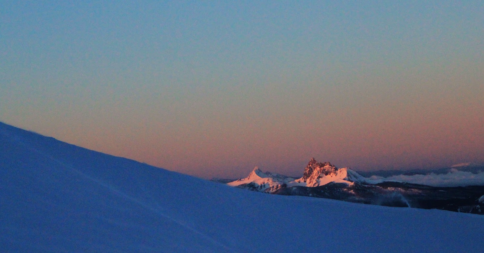
Three Fingered Jack in the foreground, with Mt. Washington behind. Actual distance to these peaks is 20-40 miles.


Three Fingered Jack, Mt. Washington, North Sister, Middle Sister, South Sister, and Broken Top. Later in the day, we could see from Mt. Rainer to Mt. McLoughlin, a straight line distance of over 300 miles!

Wind launching spin drift off the ridge crest.


Mt. Hood to the north.
 The further we climbed, the more the wind picked up. It never blew much above 25MPH, but still it was difficult of Anastasia being so much lighter than me. We decided to short rope going up the 45 degree slope because the wind made her feel off balance. We crested the ridge just as the sun appeared over the edge of the mountain.
Winds whipping snow off of Smith Peak, a sub peak on the ridge.
 Between post holing, a long approach, winds, and poor snow it took some time to climb the few hundred feet up the ridge to the base of Smith Peak.
The slope on Smith Peak, Jefferson Park Saddle, the Mohler Tooth, and the KER.

Looking down the 45-50 degree ridge. The prominent rock feature lower down is known as the Prehistoric Monster.
The snow and winds improved steadily as the sun rose and we climbed higher. On the final traverse Anastasia's plastic boot became untied and it took more time to reach the saddle. There we rested briefly, I racked up, and we set out.
The spectacular Mohler Tooth and the North Ridge frame the upper part of the Jefferson Park Glacier. The total height of the Mohler Tooth at its highest point is close to 600 feet.
Leading out. Photo-A. Blagoveshchenskaya

 The route goes to the rime step, down and right, then up a chute. The first time I climbed this there was solid ice, not so this time. The rime was more like packed powder with some ice well buried under worthless rime. I had to club the tools into the awful stuff until they stuck enough to keep my balance, then reach down, press on the wall and walk my feet up. Very much like climbing a friction chimney, only on ice with 600 feet of exposure. Desperate climbing. Pro for the chute was two worthless 10cm screws with a screamer on one. One inch in they blew through into air.
At the first belay. Photo-A. Blagoveshchenskaya
Looking down the nearly vertical rime chimney and 600' of exposure. Photo-A. Blagoveshchenskaya
 I led the remaining pitch which included some equally desperate down climbing. Due to recent snowfall, all the rocks were covered with four inches of unconsolidated powder. Down climbing involved involved dragging my tools through the snow until I found some purchase, hanging, and searching for purchase for my feet. Scary! When Anastasia followed, I lowered her off a horn and then she climbed up to me where we set up the rappel.
The view from our high point along the summit ridge to the summit pinnacle (300' high).
 Anastasia expressed some concerns about the rappel sticking, but I was eager to get out before it got any warmer so I convinced her to go. I should have listened because she was absolutely right.
Rapping off the first time. It's about 40 feet to the snow ramp. Photo-A. Blagoveshchenskaya
 Not wanting to wait around to climb up the rope, I dropped my pack and soloed a short, but slightly overhanging rime step and the climbed back along the ridge. Total time was around two minutes versus a half an hour. I added a sling to the system so the rope hung free and rapped once again.
The top of the solo and the stuck rope. Photo-A. Blagoveshchenskaya
Unfortunately, we decided to leave my cordelette there so that we could rappel down the 50 degree chute. Photo-A. Blagoveshchenskaya

 Following the rappel, I lowered Anastasia on a hip belay, then down climbed to her location. I led through, placing a pin and an orange link cam in classic volcanic rock.
The down climbing route followed the chute down from the saddle between the Mohler tooth and the Ridge. Anastasia can be seen sitting in a protected cove in the second shadow. Ever a challenge, the exit (behind the camera) was similar to the down climb on the ridge.
Classic cascades pin.
Back at the car right at nightfall. Now a 2.5 hour drive.
Once back at the saddle we rested and melted water, recuperating for the descent. I was particularly worried about the rapidly warming temps and so we left as soon as we were fed and watered. Anastasia's crampons were balling and down climbing the steep side hill was challenging. It took several hours to reach safety on the other side of the prehistoric monster. We then got away with glisading the open bowl in very slushy conditions. It was now very late (6PM) and we needed to get back to the trail before dark. I re-broke the trail back down the ridge sinking at least up to the top of my boots every step, but we made it out to the trail by 8PM. Another hour out the trail and we were back at the car, 22 hours after setting out. I drove back and was back at the house by 1:30, 35 hours after leaving.
Having to turn around so close (.2 miles, 400') from the summit only adds to the desire to climb to mountain. My father always reminds me that he climbed it solo on his first try (via Mill Creek North Gully), but then again he almost died from rock fall. Jefferson is certainly a challenging mountain and it deserves more attention than it receives.